
The Giverny Residences
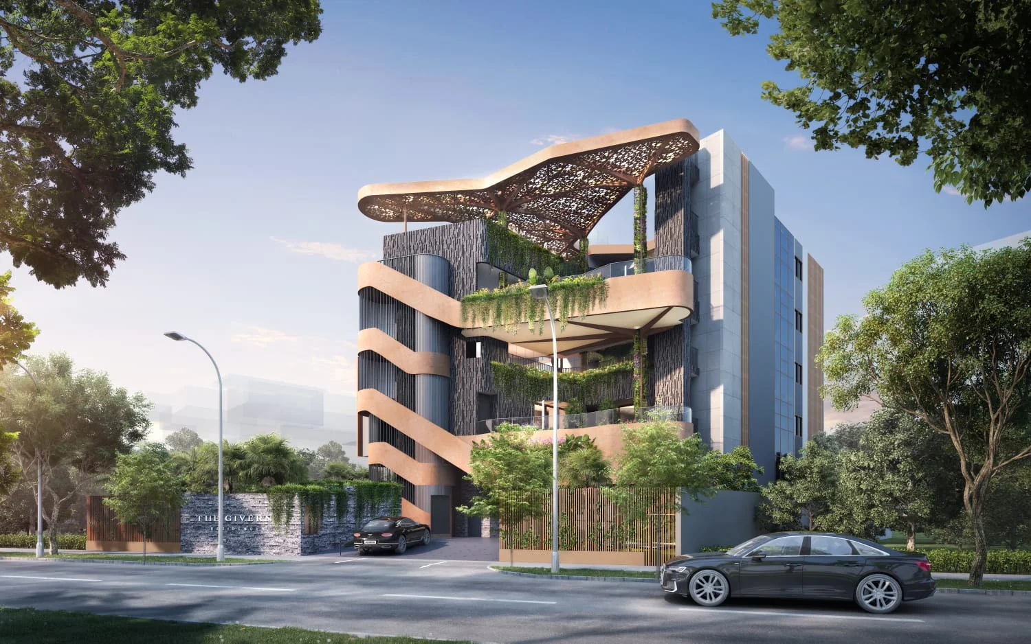
D10 · Freehold
Explore The Giverny Residences at Robin Drive, with project details, nearby amenities and home layouts.
- Location
- Robin Drive
- District
- D10
- Developer
- Robin Development Pte Ltd
- Tenure
- Freehold
- Project units
- 6
Location & nearby places
Approximate location: Approximate historical project location. Interactive map requires JavaScript and map tiles to load.
Approximate project position, not a surveyed boundary or an entrance. Source
Representative point inside independently address-matched OpenStreetMap building/site geometry; not a surveyed centroid or boundary
- The RitualFood & drinkApproximately 66 m straight-line distanceSource
- McDonald'sFood & drinkApproximately 71 m straight-line distanceSource
- Brew MaisonFood & drinkApproximately 76 m straight-line distanceSource
- Cold StorageSupermarketsApproximately 80 m straight-line distanceSource
- After Stevens Station Exit 5Bus stopsApproximately 172 m straight-line distanceSource
- Leng Kwang Baptist ChurchBus stopsApproximately 182 m straight-line distanceSource
- Before Stevens Station Exit 2Bus stopsApproximately 206 m straight-line distanceSource
- StevensRail stationsApproximately 228 m straight-line distanceSource
- Malcolm ParkParksApproximately 409 m straight-line distanceSource
- Anglo-Chinese School (Primary)SchoolsApproximately 836 m straight-line distanceSource
- Finest GourmetSupermarketsApproximately 894 m straight-line distanceSource
- Balmoral PlazaMalls & marketsApproximately 920 m straight-line distanceSource
- CS FreshSupermarketsApproximately 975 m straight-line distanceSource
- Kheam Hock Nature WayParksApproximately 1,002 m straight-line distanceSource
- Campus ParkParksApproximately 1,009 m straight-line distanceSource
- Delfi OrchardMalls & marketsApproximately 1,319 m straight-line distanceSource
- NewtonRail stationsApproximately 1,319 m straight-line distanceSource
- Orchard TowersMalls & marketsApproximately 1,349 m straight-line distanceSource
- Botanic GardensRail stationsApproximately 1,369 m straight-line distanceSource
- WatsonsHealthcareApproximately 1,408 m straight-line distanceSource
- Olive TreeHealthcareApproximately 1,440 m straight-line distanceSource
Nearby places are selected reference points, not a complete amenity directory. Distances are approximate, not walking routes or school-admission eligibility.
Amenity data © OpenStreetMap contributors, available under ODbL 1.0. View source data.
Units & asking prices in snapshot
Source · Checked · Provider date: 28 Oct 2026
Dated snapshot, not a live feed. Availability may have changed since the check above.
- Units in snapshot
- 4
- Residential
- 4
- Commercial
- 0
| Bedroom / type | Area shown (sq ft) | Units in snapshot | Asking price from | Asking price / sq ft |
|---|---|---|---|---|
| 3 BedroomA · Residential | 1,873 | 1 | S$5,975,000 | S$3,190.07Calculated from “Price From” ÷ the single area shown |
| 3 BedroomB · Residential | 1,841 | 1 | S$5,982,000 | S$3,249.32Calculated from “Price From” ÷ the single area shown |
| 4 BedroomE · Residential | 2,734 | 1 | S$9,979,000 | S$3,649.96Calculated from “Price From” ÷ the single area shown |
| 4 BedroomF · Residential | 2,551 | 1 | S$9,566,000 | S$3,749.90Calculated from “Price From” ÷ the single area shown |
Provider asking prices and availability. “Price From” is a starting price for the displayed type, not an achieved sale price. Availability can change.
Ask FindSpace for the latest details ↗URA recorded transactions
Past sale transactions
Sales history: Oct 2021–Oct 2026
2 records · latest first
| Contract month | Sale type | Floor range | Area (sq ft) / basis | Sale price | Sale PSF | Units |
|---|---|---|---|---|---|---|
| Apr 2026 | New sale | 01-05 | 1,636.1 · Strata | S$5,442,030 | S$3,326.19 | 1 |
| Mar 2026 | New sale | 01-05 | 2,755.6 · Strata | S$9,820,800 | S$3,563.99 | 1 |
Sale prices use URA’s recorded price. PSF is calculated from that price and the reported strata or land area for single-unit sales. Multi-unit transactions show the total price and unit count. Recent records may be added or revised.
URA private residential property data. Calculations by FindSpace. Source · Singapore Open Data Licence
Floorplans & site plans
Site plan
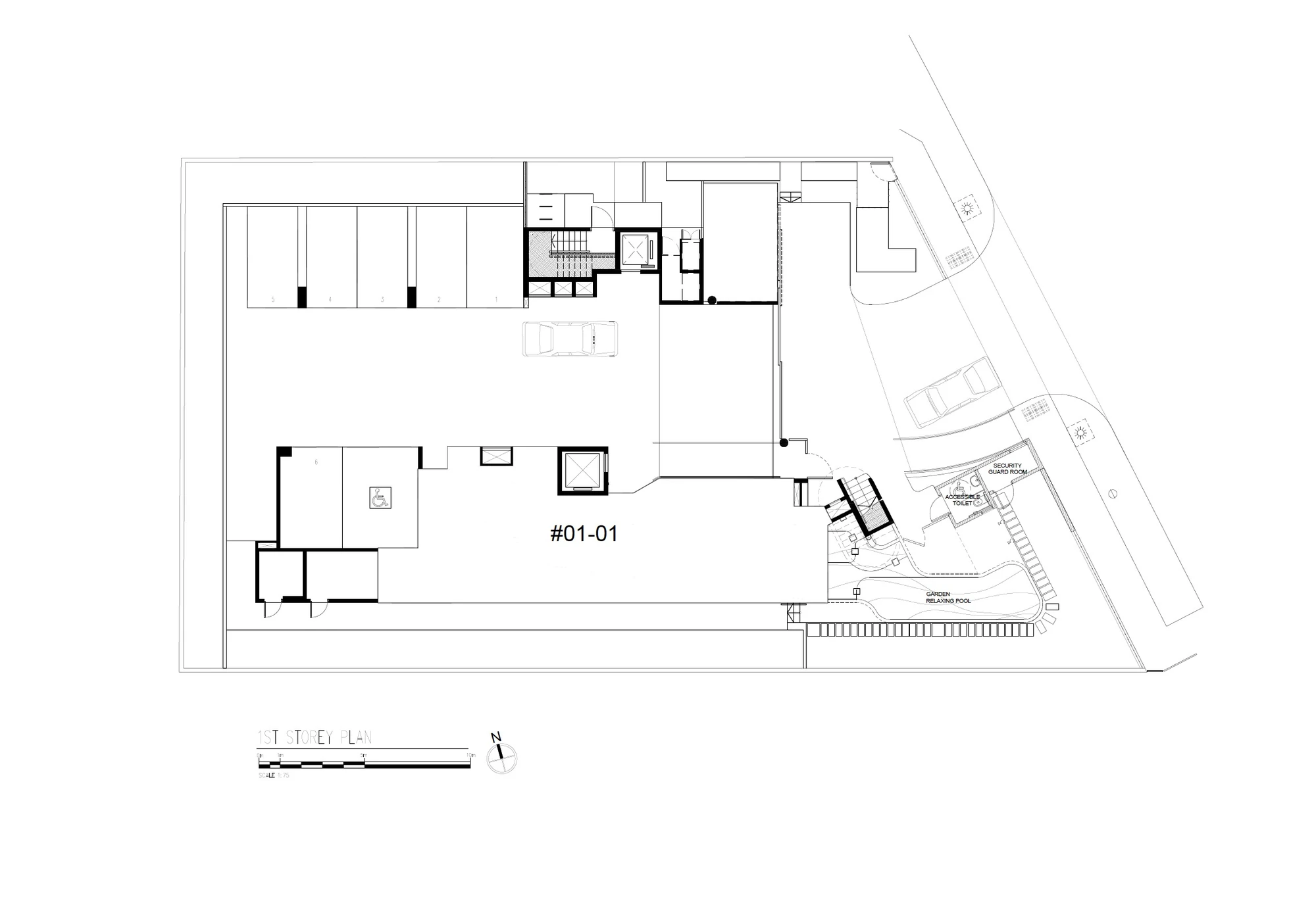
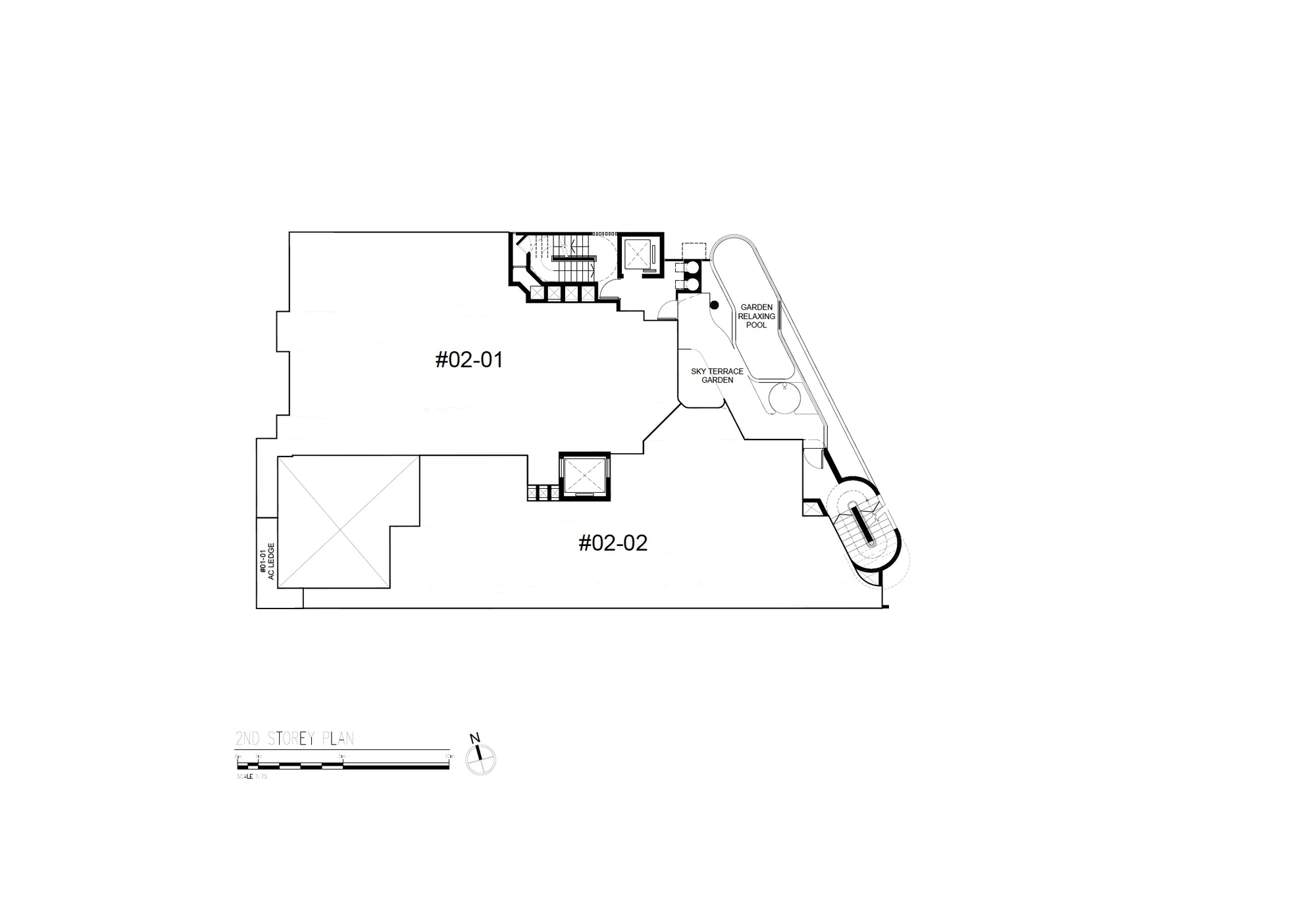
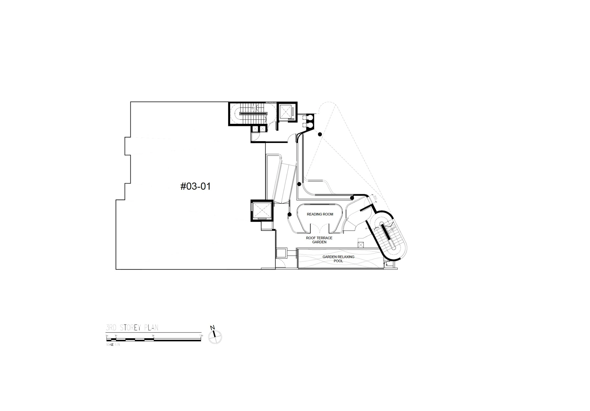
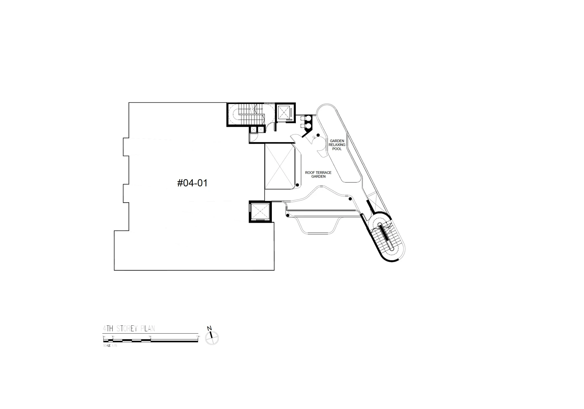
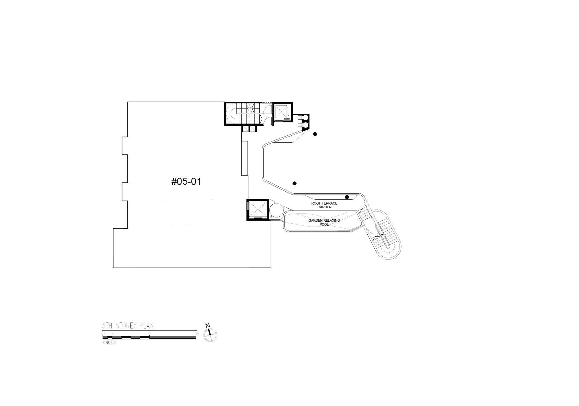
Floorplans
Select a plan to view it at full size.
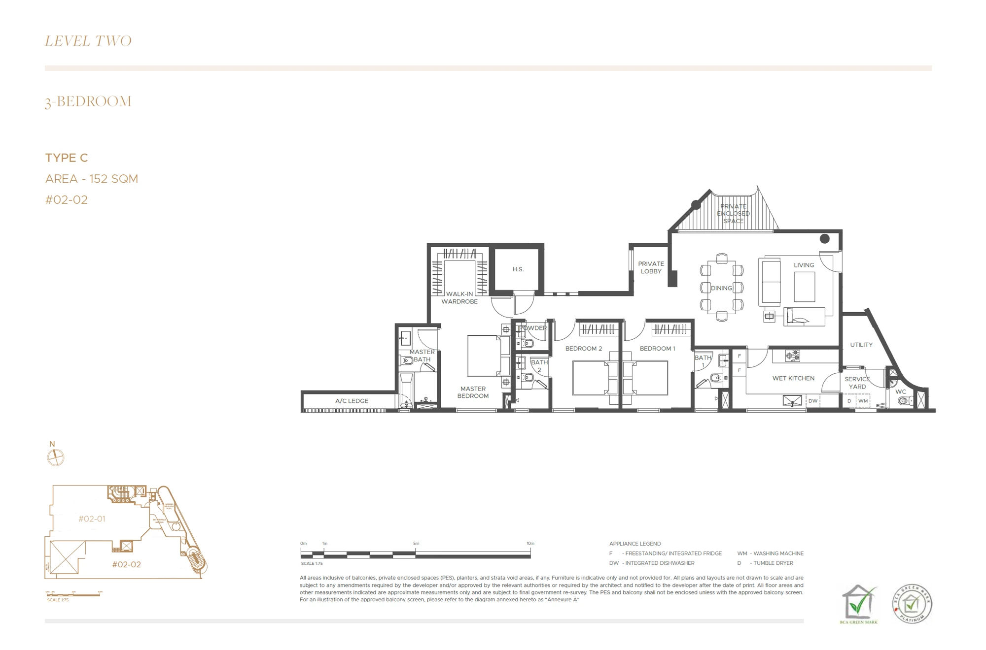
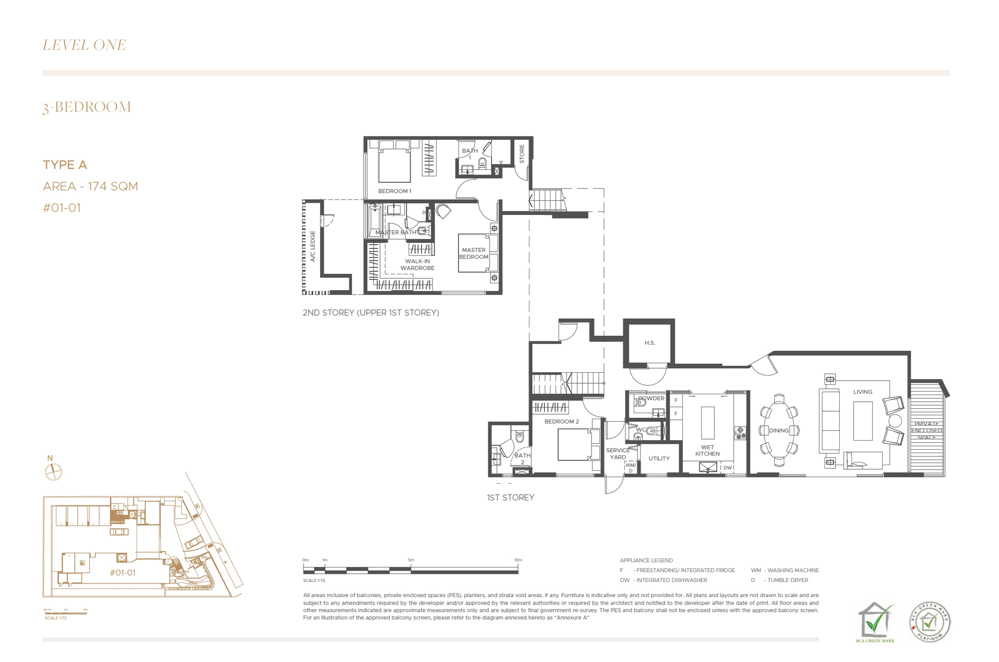
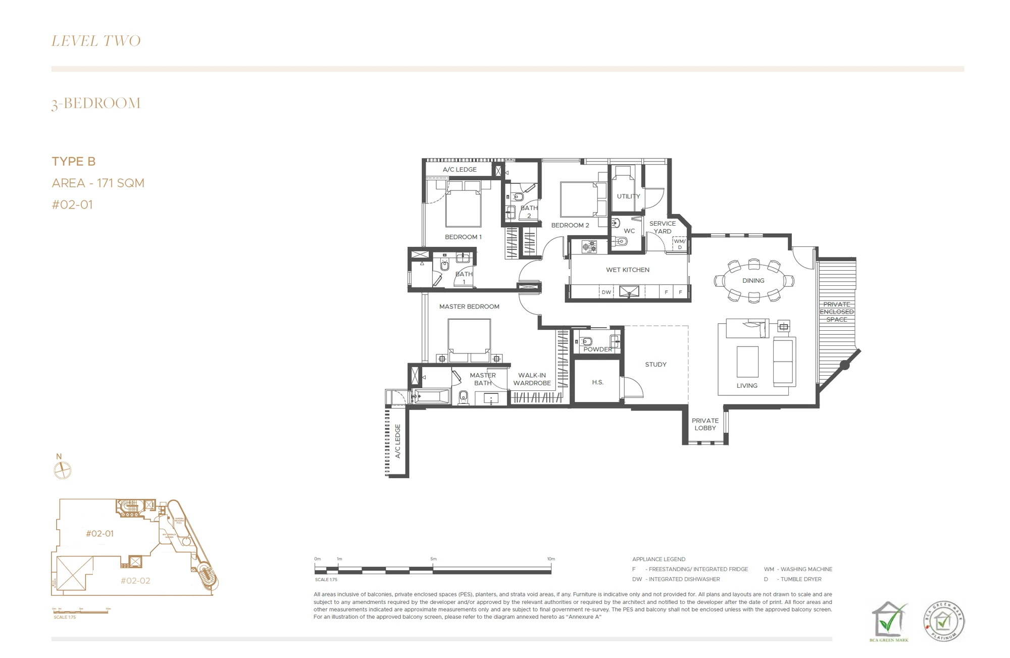
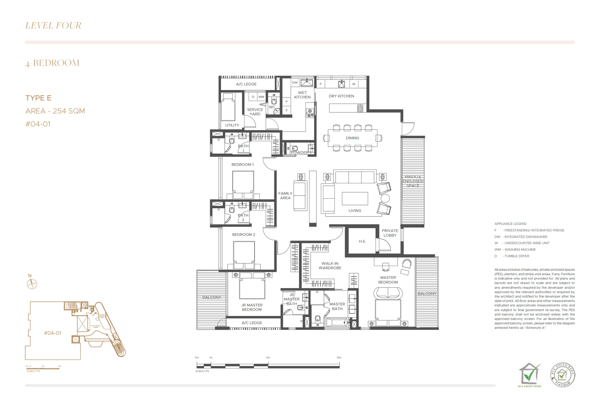
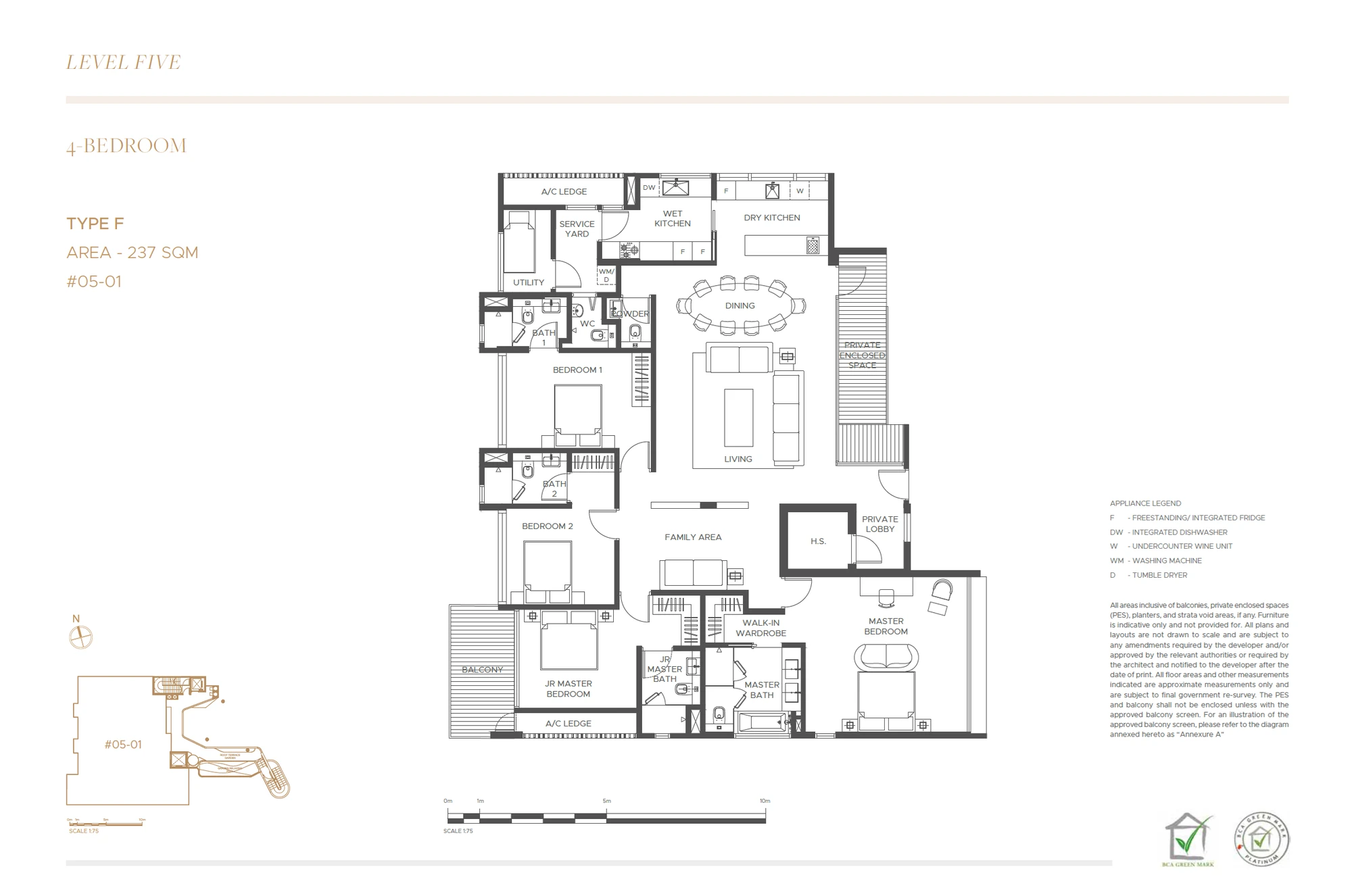
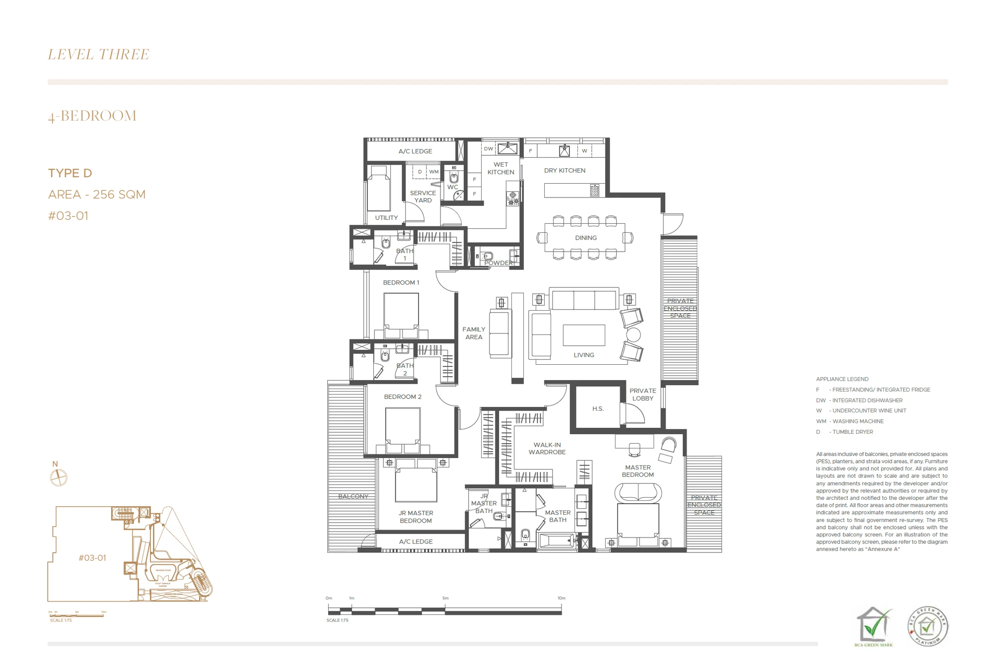
Plans are illustrative. Refer to the developer’s sale documents for dimensions and specifications.
Layout sizes
Browse the home types and floor areas. Availability is listed separately under units and prices.
| Type | Bedrooms | Size (sq ft) | Category |
|---|---|---|---|
| A | 3 | 1,873 | Residential |
| B | 3 | 1,841 | Residential |
| C | 3 | 1,636 | Residential |
| D | 4 | 2,756 | Residential |
| E | 4 | 2,734 | Residential |
| F | 4 | 2,551 | Residential |
Areas may include balconies, terraces or other spaces. Refer to the developer’s plans for the exact layout and area definitions.
Recorded property transactions
Rental rates and contracts
Explore completed transactions alongside the launch asking prices and availability above.
Rental rates by home type
No matched rental contracts are available for this property in this dataset.
Monthly rental price per square foot is an interval calculated from the source area band. Open-ended or missing area bands do not produce an exact rental PSF. These completed contracts are separate from advertised asking rents.
Recorded transactions: URA property data.
Sun & shadows
FindSpace Property Fundamentals
Score evidence: 45% covered
38.51 known points. An overall grade needs evidence for every factor; missing points are not redistributed.
| Factor | Points | Basis |
|---|---|---|
| Relative price | — / 20 | Needs at least five recent property sales and five eligible peer properties; this cohort has 1 property sales and 0 eligible peers. National peer group: location differences affect prices. PSF uses source-recorded area, not a harmonised common measurement regime; included spaces and area rules may differ. |
| Recorded-price trend | — / 15 | Needs at least twenty cohort sales in each annual window; observed 2 recent and 2 prior sales. National cohort trend; this is not a local neighbourhood trend. Changes in area measurement regimes can also affect recorded PSF. |
| Transaction activity | — / 20 | Needs five recent property sales and five eligible peers; this cohort has 1 property sales and 0 peers. National peer group: location differences affect prices. |
| Rail access | 17.72 / 20 | Closest eligible recorded rail point within 2 km: Stevens. Straight-line distance from approximate source points, not a walking route. The source extract may not contain every nearby feature. |
| Everyday amenities | 5.79 / 10 | Mean distance to the closest recorded supermarket, healthcare and park points, each within 1.5 km. Historical source extract, not a complete national amenity inventory; straight-line distances are not walking routes. |
| Tenure | 15.00 / 15 | Freehold; tenure component receives the maximum score. |
The same factors, weights and grade bands apply across new launches, private resale, landed and HDB. Recorded evidence is not a valuation or forecast.
Open the research, cohort details and redevelopment evidence →